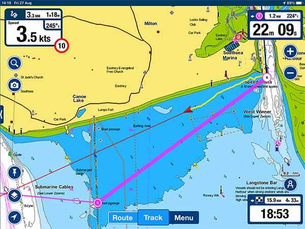
For $3.99, you can also get “premium weather,” including radar and satellite imagery. Garmin BlueChart Mobile is free and includes a high-level world chart BlueChart maps can be purchased in-app (U.S. Unless you’re connected to a Garmin Quatix watch or an onboard Garmin network, the app cannot enable an active route, provide a “go to” navigation display or import waypoints and routes. The app is not intended to replace a chartplotter, but it is well suited for route planning. You can also sync between Garmin devices, planning a route on, say, your iPad, then wirelessly syncing it with your Garmin chartplotter. For route planning, the app integrates with ActiveCaptain, which I consider a huge plus. The app has a complete set of features, including tides and currents, sun and moon phases, wind speed and direction, and a distance-measuring tool.

While underway, your position and selected route display clearly. The radial menu, waypoints and route management are extremely intuitive.

This is one of my favorite navigation apps, because it is based on Garmin’s excellent BlueChart marine charts and is so easy to use.

Garmin BlueChart Mobile uses high-quality charts


 0 kommentar(er)
